Warning for tourists ‘in exposed locations’ as Storm Ellen heads in our direction
Batten down the hatches.
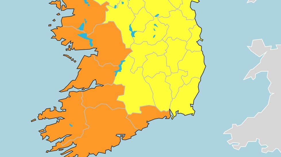
Met Éireann has issued a Status Orange Wind Warning for Cork, Kerry, Galway, Mayo, Clare, Limerick and Waterford tonight as Storm Ellen approaches Ireland.
Storm Ellen will track over Ireland tonight and tomorrow, bringing a period of severe and potentially damaging winds. The alert kicks in at 21:00 and remains in place until 12:00 on Thursday so now would be a good time to tie down the trampoline.
“Met Éireann has named Storm Ellen for disruptive and potentially damaging winds Wednesday evening (19th) and throughout Thursday (20th). Due to the combination of storm surge, spring tides and onshore winds there is a risk of some coastal flooding,” said Evelyn Cusack, Head of forecasting, Met Éireann.
“There is a risk also of some inland and river flooding with some potentially heavy, thundery downpours.
Our Meteorologist Commentary on #StormEllen is available here https://t.co/ktXtWjbfIg pic.twitter.com/0svXEBk5VU
— Met Éireann (@MetEireann) August 18, 2020
“Status Orange/Yellow wind warnings are in effect for the Island of Ireland and will be updated Wednesday morning. Orange level impacts may potentially occur over any part of the Island and tourists in exposed locations, in particular, will be at risk for these unseasonable stormy and wet conditions.”